 Vancouver Island - Hwy 1 (Vancouver Island)
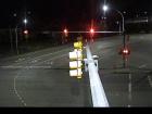
Departure Bay northbound
Hwy 1 at Zorkin Rd/Brechin Rd, looking northbound to Brechin Road.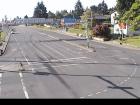
Departure Bay southbound
Hwy 1 at Zorkin Rd/Brechin Rd, looking to Stewart Avenue.
Departure Bay Ferry
Hwy 1 at Zorkin Rd/Brechin Rd, looking at Departure Bay Ferry Terminal.
Departure Bay - Zorkin Rd
Hwy 1 at Zorkin Rd/Brechin Rd, looking to Zorkin Road.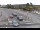
Comox Rd - N
Hwy 1, at Comox Rd and Terminal Ave in Nanaimo, looking north.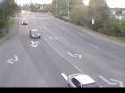
Comox Rd - W
Hwy 1, at Comox Rd and Terminal Ave in Nanaimo, looking west.
Comox Rd - E
Hwy 1, at Comox Rd and Terminal Ave in Nanaimo, looking east.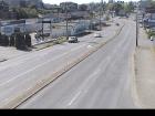
Comox Rd - S
Hwy 1, at Comox Rd and Terminal Ave in Nanaimo, looking south.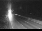
Nanaimo Airport - N
Hwy 1, at Vowels Rd next to Nanaimo Airport, looking north.
Nanaimo Airport - S
Hwy 1, at Vowels Rd next to Nanaimo Airport, looking south.
Ladysmith
Hwy 1 at South Davis Rd, south of Ladysmith, looking south.
Chemainus
Hwy 1 at Henry Rd near Chemainus, looking south.
Herd Rd - N
Hwy 1, at Herd Rd/Cowichan Valley Hwy, about 5 km north of Duncan, looking north.
Herd Rd - W
Hwy 1, at Herd Rd/Cowichan Valley Hwy, about 5 km north of Duncan, looking west.
Herd Rd - E
Hwy 1, at Herd Rd/Cowichan Valley Hwy, about 5 km north of Duncan, looking east.
Herd Rd - S
Hwy 1, at Herd Rd/Cowichan Valley Hwy, about 5 km north of Duncan, looking south.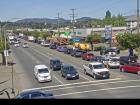
Duncan - N
Hwy 1 in Duncan at Trunk Rd, looking north.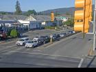
Duncan - E
Hwy 1 in Duncan at Trunk Rd, looking east.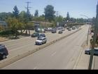
Duncan - S
Hwy 1 in Duncan at Trunk Rd, looking south.
Cobble Hill Rd
Hwy 1 at Cowichan Bay Rd/Cobble Hill Rd, looking south.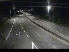
Mill Bay - N
Hwy 1 at Shawnigan Mill Bay Rd, looking north.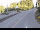
Mill Bay - W
Hwy 1 at Shawnigan Mill Bay Rd, looking west.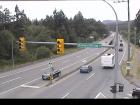
Mill Bay - S
Hwy 1 at Shawnigan Mill Bay Rd, looking south.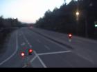
Butterfield Rd - N
Hwy 1, approximately 3 km south of Mill Bay, looking north.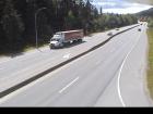
Butterfield Rd - S
Hwy 1, approximately 3 km south of Mill Bay, looking south.
Bamberton - N
Hwy 1 south of Mill Bay Rd Overpass at the Bamberton Park Entrance, looking north.
Bamberton - S
Hwy 1 south of Mill Bay Rd Overpass at the Bamberton Park Entrance, looking south.
Malahat Summit - N
Hwy 1, about 3.7 km south of Bamberton, looking northbound.
Malahat Summit - S
Hwy 1, about 3.7 km south of Bamberton, looking southbound.
Malahat Drive - N
Hwy 1 at South Shawnigan Lake Road, looking north.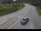
South Shawnigan Lake Rd - W
Hwy 1 at South Shawnigan Lake Rd, looking west.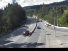
Malahat Drive - S
Hwy 1 at South Shawnigan Lake Road, looking south.
Okotoks - N
Hwy 1 at Okotoks Road, looking north.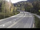
Okotoks - S
Hwy 1 at Okotoks Road, looking south.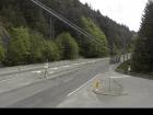
Tunnel Hill - N
Hwy 1 at Tunnel Hill on the Malahat, looking north.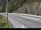
Tunnel Hill - S
Hwy 1 at Tunnel Hill on the Malahat, looking south.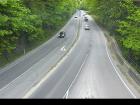
Goldstream - N
Hwy 1, in Goldstream Park at Finlayson Arm Rd, looking north.
Goldstream - S
Hwy 1, in Goldstream Park at Finlayson Arm Rd, looking south.
Hwy 1 at West Shore Pkwy northbound
Hwy 1 at West Shore Parkway, looking northbound toward Goldstream Park.
West Shore Parkway
Hwy 1 looking west along West Shore Parkway.
Hwy 1 at West Shore Pkwy southbound
Hwy 1 at West Shore Parkway, looking southbound towards Victoria.
Spencer Rd - W
Hwy 1 at Spencer Rd, northbound looking west.
Spencer Rd - E
Hwy 1 at Spencer Rd, southbound looking east.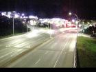
Millstream Rd - N
Hwy 1 at the Millstream Interchange, looking north.
Millstream Rd - W
Hwy 1 at Millstream Interchange, looking west.
Millstream Rd - E
Hwy 1 at Millstream Interchange, looking east.
Colwood - W
Hwy 1, northbound, near the View Royal/Colwood exit, looking west.
Colwood - E
Hwy 1, southbound, near the View Royal/Colwood exit, looking east.
Helmcken - N
Hwy 1 at Helmcken Overpass looking north
Helmcken - W
Hwy 1 at Helmcken Overpass, looking west.
Helmcken - E
Hwy 1 at Helmcken overpass, looking east.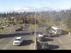
Helmcken - S
Hwy 1 at Helmcken overpass, looking south.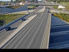
Admirals-McKenzie - N
Hwy 1, at Admirals Rd - McKenzie Ave, looking north.
Admirals-McKenzie - W
Hwy 1, at Admirals Rd - McKenzie Ave, looking west.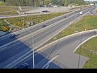
Admirals-McKenzie - E
Hwy 1, at Admirals Rd - McKenzie Ave, looking east.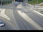
Admirals-McKenzie - S
Hwy 1, at Admirals Rd - McKenzie Ave, looking south.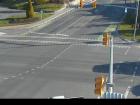
Tillicum - N
Hwy 1 at Tillicum Rd, looking north.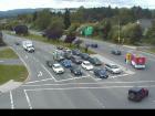
Tillicum - W
Hwy 1 at Tillicum Rd, looking west.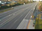
Tillicum - E
Hwy 1 at Tillicum Rd, looking east.
Tillicum - S
Hwy 1 at Tillicum Rd, looking south.
Carey Rd - NW
Hwy 1 at Carey Road, looking northwest.
Carey Rd - SE
Hwy 1 at Carey Road, looking southeast.


